
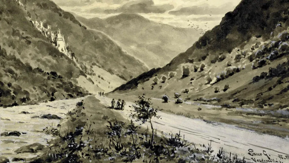
Verecke’s Famous Mountain Pass
It is hardly an exaggeration to say that there is scarcely a Hungarian anywhere in the world whose heart does not beat a little faster at the mention of Verecke. Standing beside the monument to the Hungarian Conquest, designed by the sculptor Péter Matl (from Munkács), and gazing
Szerző: Nánay Mihály
Megosztás
It is hardly an exaggeration to say that there is scarcely a Hungarian anywhere in the world whose heart does not beat a little faster at the mention of Verecke. Standing beside the monument to the Hungarian Conquest, designed by the sculptor Péter Matl (from Munkács), and gazing out over the surrounding landscape, it is difficult not to feel a heightened sense of one’s Hungarian identity. Most people associate the famous pass with Chieftain Árpád—and rightly so. Yet Verecke has played a significant role in Hungarian history on many other occasions as well. We therefore invite our readers on a journey spanning more than eleven centuries as we explore the history of this remarkable mountain pass. And if the story captures your imagination, Verecke is certainly a place worth visiting.
A Barrier or a Gateway?
When one thinks of the Verecke Pass, the image that comes to mind is perhaps a dramatic mountain landscape reminiscent of the towering peaks of the High Tatras or the Fogaras (Făgăraș) Mountains. One might even imagine Árpád and the Hungarians accomplishing a feat comparable to Hannibal’s legendary crossing of the Alps as they made their way across the Carpathians. The reality, however, is rather different.
The Verecke Pass lies only 839 meters above sea level—and it is not even the lowest pass in the region: at the Dukla Pass, the Carpathians descend to only 502 metres. Indeed, the Northeastern Carpathians form the lowest section of the great Carpathian arc. Most of them today lie in Ukraine, though they also extend into Slovakia, Poland, and Romania.
Within this broader region, only the Máramaros (Maramureș) Mountains have peaks rising above 2,000 meters. Consequently, in 1939–40—before Northern Transylvania, including the Radna (Rodna) Mountains, was returned to Hungary—the country’s highest point was located here. Today, that same peak, Hóvár (Hoverla), is the highest point in Ukraine.

The mountain range forms an important watershed. On the slopes leading towards the Carpathian Basin rise the two headwaters of the Tisza (Tisa), while the Prut and the Dniester flow eastward on the other side of the watershed. No major river in the region succeeds in cutting it through, making it a significant topographical divide. Perhaps surprisingly, this area is also the rainiest part of the Carpathian Basin, receiving around 1,500 mm of precipitation annually (air masses arriving from the west rise over the mountains and, as they cool, release their moisture).
Most of the Northeastern Carpathians and the Máramaros Mountains consist of relatively soft sedimentary rock. This explains why, compared with the imposing crystalline ranges of the Tátra and the Fogaras Mountains, the landscape here is gentler, lower, and more rounded. Even the ranges above 1,000 meters are largely covered with forests or, at most, by high mountain grasslands; rugged alpine landforms sculpted by glaciers are few and far between.
The landscape around the Verecke Pass therefore resembles rolling hill country more than a high mountain range. Thus, it is hardly surprising, that it offered one of the principal gateways into the Carpathian Basin for peoples arriving from the east. The valley of the Stryi River provides a relatively easy route up to the pass, while from there the road descends into the basin along the Latorca River.
A landscape of precisely this kind also appears in Árpád Feszty’s famous panoramic painting of the Hungarian Conquest. The location depicted has been identified near Munkács (Mukachevo), where the artist is known to have made his preparatory sketches.

The Hungarian Conquest
Relatively little is known about the course of the Hungarian Conquest. It seems increasingly likely that the settlement of the Hungarians in the Carpathian Basin was a more deliberate process and took place over a longer period than the “traditional” historical narrative that emerged in the late 19th century would suggest. The first documented Hungarian military campaign in the Carpathian Basin took place in 862, so the traditional date of 895 is better regarded as the culmination of this process rather than its beginning. It nevertheless seems clear that the main force led by Álmos and Árpád entered the Carpathian Basin around 895. For this reason, if we speak of the Conquest in symbolic terms, we may still reasonably take 895 as its date.
But where is the symbolic location of the conquest? Contemporary sources are silent on the matter. The only useful information comes from Anonymus, the 12th-century historian, according to whom Árpád and his people first stopped at Munkács—which is also why Árpád Feszty studied the landscape in that region. If this was indeed the case, historians reasoned, they must have descended from the Carpathians through the valley of the Latorca (Latorica), since Munkács stands at the point where the river valley opens onto the plain. And at the head of the Latorca valley lies the Verecke Pass.
It was through this line of reasoning that late 19th-century historians identified Verecke as the site of the Hungarian Conquest, an association that became firmly embedded in Hungarian historical consciousness during the Millennium celebrations. Today, of course, it is generally accepted that Hungarians did not enter the Carpathian Basin on a single occasion or through a single pass, since several other passes lay within a relatively short distance, including the Tatár (Yablunytsia) and the Borsai (Prislop) Passes. Nevertheless, following Anonymus, there are good grounds for singling out Verecke among the region’s several mountain passes.
Hungarian historical consciousness in the 19th century attached particular significance to the pass, and in 1896, on the occasion of the Millennium, an obelisk was erected there to commemorate the Conquest. It was removed during the Soviet period, and it was not until 1996 that a new monument worthy of the symbolic site could be erected. The monument, designed by sculptor Péter Matl, represents a gateway opening onto the Carpathian Basin, while its seven divisions symbolize the seven conquering Hungarian tribes. Although the monument continues to provoke strong hostility among Ukrainian nationalists from Lemberg (Lviv)—and has even been vandalized and partly destroyed on occasion—it still stands today and has become something of a pilgrimage site for Hungarians visiting Transcarpathia. It is not particularly easy to find, however, as there is no sign beside the Ukrainian Second World War memorial indicating the way to it.
The Mongol Invasion
The Verecke Pass remained an important route after the Conquest. Hungarian kings frequently travelled through it on campaigns towards the Slavic Principality of Halych (like Andrew II) or returned through it from the direction of Kyiv, as Andrew I did. At the end of 1240, however, news arrived of movement from the east: the Mongols had captured Kyiv and made it unmistakably clear to the Hungarian king that a similar fate awaited his kingdom. Béla IV dispatched his loyal supporter, Palatine Dénes of the Tomaj clan, with several thousand soldiers to the northeastern passes to halt the invaders.
The Palatine had the river valleys blocked with massive wooden barricades—a strategy that inevitably brings to mind the Árpád Line defensive system of the Second World War. The obstacles, however, failed to serve their purpose. The Mongols drove ahead of them a large force of woodcutters from Rus (forty thousand according to the chronicle of Thomas of Spalato, although this figure is undoubtedly exaggerated) who quickly hacked apart the carefully constructed defenses.
The chronicles are silent about the details of what followed. What is certain is that on 12 March 1241, the invading Mongols destroyed Dénes's army near Munkács. The Palatine himself was seriously wounded and barely managed to escape. Three days later he reached Buda and reported to the king that the main Mongol forces had broken into Hungary through the Verecke Pass. The events that followed—the story of the Cumans and the Battle of Muhi—are well known. Dénes of the Tomaj clan was himself to give his life fighting for the kingdom on the battlefield beside the Sajó river.
The Ruling Prince
A century later, from the end of the 14th century onwards, the direction of the greatest geopolitical threat facing the Kingdom of Hungary began to shift. As the Ottoman advance gathered momentum, the southern river crossings replaced the passes of the Northeastern Carpathians as the country’s most vulnerable points. The Verecke Pass therefore came to serve peaceful Hungarian–Polish relations rather than the movement of large armies. Yet a glance at the names of present-day settlements around the pass—including Rákócziszállás and Vezérszállás—reveals that the region once again assumed particular importance during the Rákóczi War of Independence.
Following his fortunate escape from prison in Bécsújhely (Wiener Neustadt), Rákóczi took refuge with Miklós Bercsényi at the castle of Brezán (Brzeżany) in Poland. It was there that news reached him of the outbreak of the War of the Spanish Succession. He subsequently learned that, faced with an increasingly difficult military situation, the Imperial War Council had decided to withdraw the Montecuccoli Cuirassier Regiment from Hungary, which would have left the country without a single military unit of comparable fighting strength. Rákóczi therefore decided to answer the call of the peasants of the Tiszahát region and presented their envoys with a banner bearing the inscription “Cum Deo, pro patria et libertate” (“With God, for the Fatherland and Liberty”). His calculations did not entirely prove correct, however: because of the outbreak of the uprising, the Montecuccoli Regiment ultimately remained in Hungary.
The poorly organized forces of the Tiszahát uprising were defeated at Dolha (Dovhe) by Sándor Károlyi, Lord Lieutenant of Szatmár County and later a Kuruc general. (The Kuruc were Hungarian anti-Habsburg insurgents). Rákóczi therefore decided not to wait any longer for French and Polish assistance, but to return to Hungary before the resistance lost its momentum. He intended to enter the country through the Verecke Pass, since his estates around Munkács extended as far as the frontier. On 14 June 1703, he reached Klimiec (Klymets), the last Polish village before the border. There he met the remaining peasant soldiers led by Tamás Esze, who at first could scarcely believe that the man standing before them really was Rákóczi. His stirring speech, however, restored their courage.
![On 16 March 1939, a Polish guard of honor awaited the Hungarian troops as they reached the Verecke Pass. The Poles removed the Czechoslovak border post and erected the wooden triumphal arch visible in the other photograph. The restoration of a common Hungarian–Polish border was also of considerable geopolitical significance, and in view of this, the British likewise accepted the change in the frontier. At the ceremonial Hungarian–Polish meeting, Colonel Alajos Béldy addressed those present: “It is difficult to express the emotions that fill our hearts and souls as we stand here on Hungary’s historic frontier and find ourselves together with soldiers of the Polish Army. [...] Every Hungarian heart beats faster at the sight of a Polish guard of honor assembled here at the border to welcome us. The Polish commander greeted me with a handshake and, in accordance with an ancient Polish custom, with a kiss. This welcome touched us beyond words, for it was intended not only for us, but for the entire Hungarian Army and the whole Hungarian nation.”](https://rubiconintezet.fra1.cdn.digitaloceanspaces.com/media/0103_e54ce250_bac1_4be1_b53e_4d31046c87b6_in_content_97f0e914_2b17_4922_b8b5_e00_ce87310e28.webp)
Two days later, on 16 June 1703, the future prince re-entered Hungary through the Verecke Pass. Around midday, he stopped to rest near the village of Závadka (today Rákócziszállás). A few days later, he descended along the Latorca towards Munkács, the centre of his estates. He was soon forced to retreat towards the pass once again, after the better-trained imperial troops routed his forces at Munkács. By 30 June, Rákóczi was back at Závadka. There he was joined by the well-trained soldiers of László Ocskay and Balázs Borbély, who would later form the core of the Kuruc cavalry as well as by Bercsényi with the forces he had assembled in Poland. With these reinforcements, Rákóczi’s second advance proved successful, giving new impetus to the War of Independence.
Eight years later, on 22 February 1711, Rákóczi left Hungary by the same route. The Prince was counting on the assistance of Tsar Peter the Great and therefore decided to entrust the armistice negotiations to Sándor Károlyi, with instructions to prolong them, while he travelled personally to meet the Tsar and settle the details of their proposed cooperation. Rákóczi could not have known that this would be the last day on which he would ever set foot on Hungarian soil.
The Great Wars
In the decades following the Rákóczi War of Independence, the pass once again experienced more peaceful times. Indeed, after the Habsburg acquisition of Galicia in 1772, it could no longer really be regarded as a frontier, since Habsburg territories now extended to the outer slopes of the Carpathians as well. The Russian intervention of 1849 was an exception among invasions from the east: the main forces of Prince Paskevich entered Hungary through the Dukla Pass and therefore did not pass through Verecke.
During the Dualist era, the railway reached the region from Munkács, following the valley of the Latorca, although the railway line naturally bypassed the Verecke Pass itself. The Millennium celebrations of 1896, however, did justice to the pass, which had by then been identified as the symbolic site of the Hungarian Conquest. It was on this occasion that the first monument was erected.
At the beginning of the First World War, geopolitical realities once again brought the region to the forefront. In the autumn of 1914 and the early months of 1915, fierce fighting raged throughout the Northeastern Carpathians. The Uzsoki (Uzhok) Pass became the best known of these battlefields, but Verecke did not escape the fighting either. Russian troops crossed into Hungary here as well, although they did not penetrate very far into the country. The threat was finally lifted in the spring of 1915 by the Gorlice–Tarnów Offensive, which forced the Russian armies to retreat.
Following defeat in the First World War and the subsequent disintegration of historic Hungary, the region was occupied by Czechoslovak troops, and the pass became part of Czechoslovakia. Remarkably, however, the Millennium monument was left intact. Another major change came in 1939, when Hungary regained Transcarpathia. A particularly symbolic moment came at 2:15 p.m. on 16 March, when the first Hungarian troops reached the pass. There, Polish soldiers awaited them beneath a triumphal arch erected beside the Millennium monument, and a ceremonial handshake marked the restoration of the common Hungarian–Polish frontier.

After Poland was occupied by Germany and the Soviet Union in September 1939, Hungary found itself sharing a border with the Soviet Union. Construction of the Árpád Line began almost immediately to defend the country against the communist power, and the Verecke Pass formed part of these defensive preparations. Following the Second Vienna Award, the Soviet and Romanian frontiers that had to be defended stretched over a considerable distance. Rather than constructing a continuous line of fortifications, the Hungarians established a series of fortified valley barriers. One of the most important of these was built in the valley of the Latorca, combining anti-tank obstacles with fortified firing positions capable of covering the valley with interlocking fields of fire. During the fighting of 1944, the Árpád Line successfully held back the Soviet advance. Romania’s withdrawal from the Axis, however, enabled Soviet forces to advance through Southern Transylvania, threatening to encircle the Hungarian First Army defending the Árpád Line. The army therefore had to withdraw from its positions.


Soviet-Ukrainian rule
After the Soviet Army occupied Transcarpathia, the Verecke Pass once again became the scene of tragic events. Not long after yet another invading force from the east—this time the Soviets—had entered Hungary through the pass, and large numbers of Hungarians were once again travelling through it in the opposite direction, eastwards, as they had centuries earlier during the campaigns of the Árpádian kings into Halych. This time, however, they did so as prisoners. Tens of thousands of those assembled at Szolyva (Svaliava), near the western approach to the pass, were deported eastwards and disappeared into the Soviet prison camps. By then, the Millennium monument had also attracted the attention of the new authorities. The memorial column was demolished, leaving virtually no trace of it.


The last major development affecting the pass was the construction of a new road in connection with the Moscow Olympics. Completed by 1980, it still carries most traffic today, although the new route bypasses the pass itself. The old road winding up to the Verecke Pass gradually fell into disrepair and is now something of a test of courage for anyone attempting the ascent in a car designed for Western European roads.

Following the collapse of the Soviet Union, the new nationalist Ukrainian leadership also felt the need to assert a symbolic claim over the pass. Although renovation of the road was not considered a priority, a huge memorial to the Sich Guards was nevertheless erected. According to the Ukrainian national narrative, Hungarian troops occupying Transcarpathia killed some 600 Sich Guards at Verecke. In reality, however, the Sich Guards lost their lives on the other side of the mountain range in fighting against the Polish Army.
Today, therefore, it is this monument that greets visitors arriving at the pass, while there is virtually nothing to indicate the location of the Hungarian Conquest memorial. Unless visitors know exactly where to look, it is not easy to find.
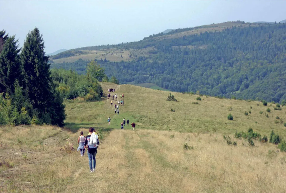
Following in the footsteps of our ancestors
Construction of the monument began in 1996 to mark the 1,100th anniversary of the Hungarian Conquest, based on designs by Péter Matl, a sculptor from Munkács. From the outset, however, the monument became a target of attacks by Ukrainian nationalists and was demolished. It was finally completed in 2008, although it has suffered numerous acts of vandalism since then.
The monument represents a gateway between East and West, opening towards Hungary. Its seven sections symbolize the seven Hungarian leaders and the seven tribes of the Conquest, while an altar stone stands at its centre. Péter Matl described his feelings about the monument as follows:
“When I was designing the monument, I felt as though our entire nation were standing behind me, as though they were helping me to create it. The true essence of the monument is not all the stone we brought here. It lies in the hearts and souls of Hungarians. It has become almost a symbol. If we have faith, we have a future; if we have a past, we have a future. If we believe in our past, then we will surely be able to preserve our Hungarian identity.”
Despite all the ups and downs of history, Verecke remains one of those places where 1,100 years of Hungarian history seem to converge at a single point. And if reading this article has inspired you not merely to travel to Verecke in your imagination, but to visit it in person, do not hesitate. It is an experience you will not soon forget.
(translated by Márta Pellérdi)